
Crop monitoring
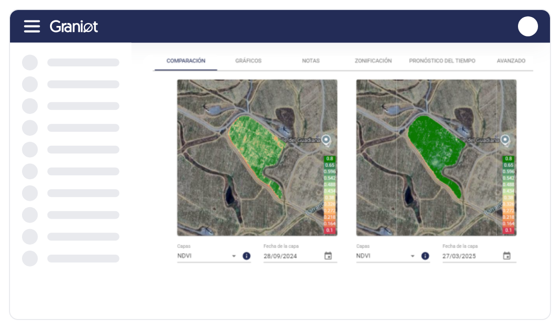
Get a continuous view of your plantation's health through advanced vegetation indices, anticipating water or nutrient problems and making decisions based on real, up-to-date data.
Eliminate manual counting and ensure accuracy. Our asset inventory service delivers the real, geo-referenced population, helping you optimize replanting and maximize the yield potential of your crop.
Your forestry inventory in 4 steps. Fast, accurate data ready for decision-making.
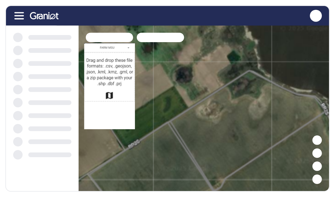
Define your area (AOI): Send us the geospatial boundaries of your parcels (GeoJSON, KML, KMZ, etc.).
Satellite acquisition: We optimize very-high-resolution image capture according to the crop.
AI analysis: Machine Learning algorithms detect, count, and measure each asset with precision.
Results delivery: Access the platform and download zoning maps, geolocation data, and health indices ready for action.
Flexibility is key. Discover how our technology adapts to your needs — through our platform, API integration, or embedded maps.
Identify the exact number of planted assets and the critical planting gaps to optimize replanting.
Eliminate the high cost and time of manual counts or drone surveys over large areas.
Continuously monitor large or remote areas without the risks of field work.
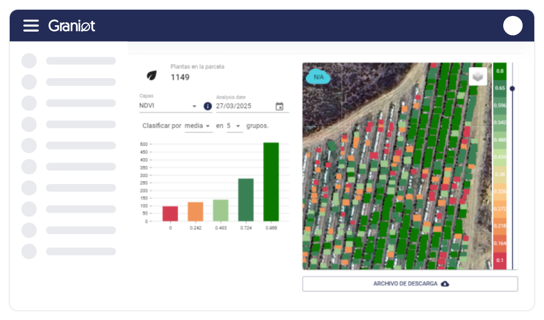
Get vegetation index statistics (NDVI) to assess the health of your assets and their yield potential.
The data is compatible and easy to integrate via API with your GIS management systems.
Inventory, no field work. Our satellite technology is the foundation for optimizing your ROI: get the geolocation and condition of every asset, including identification of critical gaps, regardless of species (palm, olive, cane, etc.).


I see the real condition of every tree and apply inputs only where my crop actually needs them.
I process thousands of parcels in a single submission and get the results without operational bottlenecks.

Now I have the exact inventory of my trees and real control over what's happening on my estate.
I have all my parcels organized on the platform and it saves me a lot of time every day.

Graniot's embedded maps let us easily incorporate satellite technology into Dataris.
Send us your questions or requirements. Our team of experts will contact you to design a tailored solution that boosts your operational efficiency.
Get a continuous view of your plantation's health through advanced vegetation indices, anticipating water or nutrient problems and making decisions based on real, up-to-date data.

Ensure full traceability of your supply chain with non-deforestation reports generated at scale, guaranteeing that every parcel meets European standards for export without legal risk.

Monitor construction progress and pavement condition remotely, using satellite data to prioritize preventive maintenance and drastically reduce technical inspection costs.
How accurate is satellite-based tree counting?
Our Artificial Intelligence algorithms are trained to outperform manual and drone-based methods, achieving high reliability in tree geolocation and counting, even in complex terrain.
What types of assets and crops can you inventory?
Our technology is versatile. We can inventory trees, palms, sugarcane, olive groves, and other plantations. The focus is on obtaining accurate population data and detecting planting gaps, regardless of species.
What information do I get about vegetation health?
We don't just count. We deliver geo-referencing, allometric measurement, and vegetation index statistics (NDVI) to assess tree health and zoning.
How accurate is planting-gap detection?
We use high-resolution Artificial Intelligence algorithms specifically trained to identify missing assets. This provides reliable data for immediate replanting decisions and yield optimization.