
Crop monitoring
Get a continuous view of your plantation's health through advanced vegetation indices, anticipating water or nutrient problems and making decisions based on real, up-to-date data.
Don't risk your access to the European market. Our geospatial engine verifies your supply chain, identifies risk per parcel, and delivers the detailed report needed to demonstrate non-deforestation in any audit.
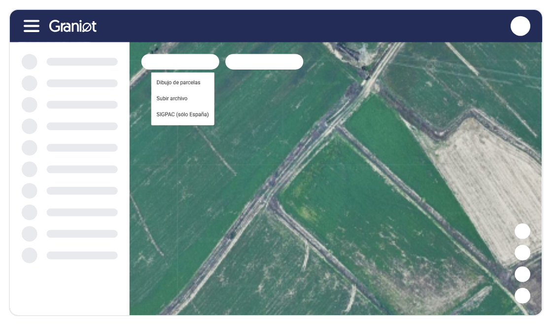
Integrate your suppliers' coordinates and verify their accuracy in real time. Eliminate location errors before processing any shipment to ensure compliance from origin.
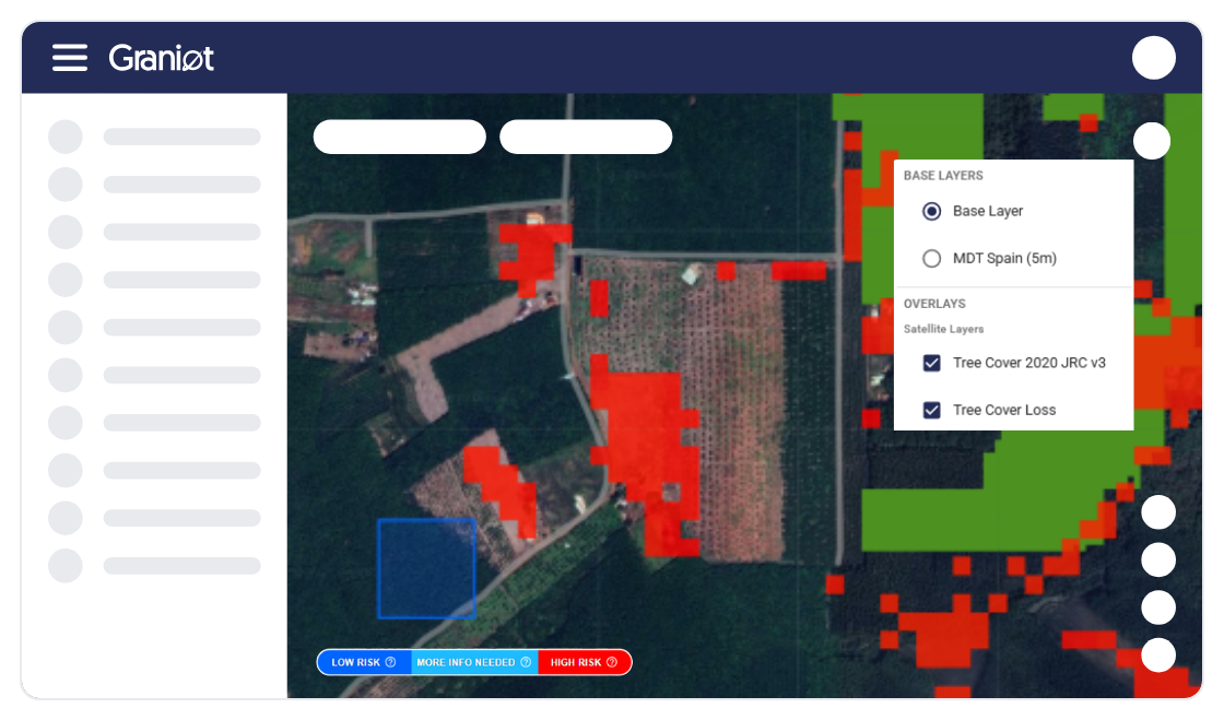
Don't rely on free public maps with high error margins. Our AI analyzes satellite imagery to guarantee your parcels are deforestation-free since 2020 with full reliability.
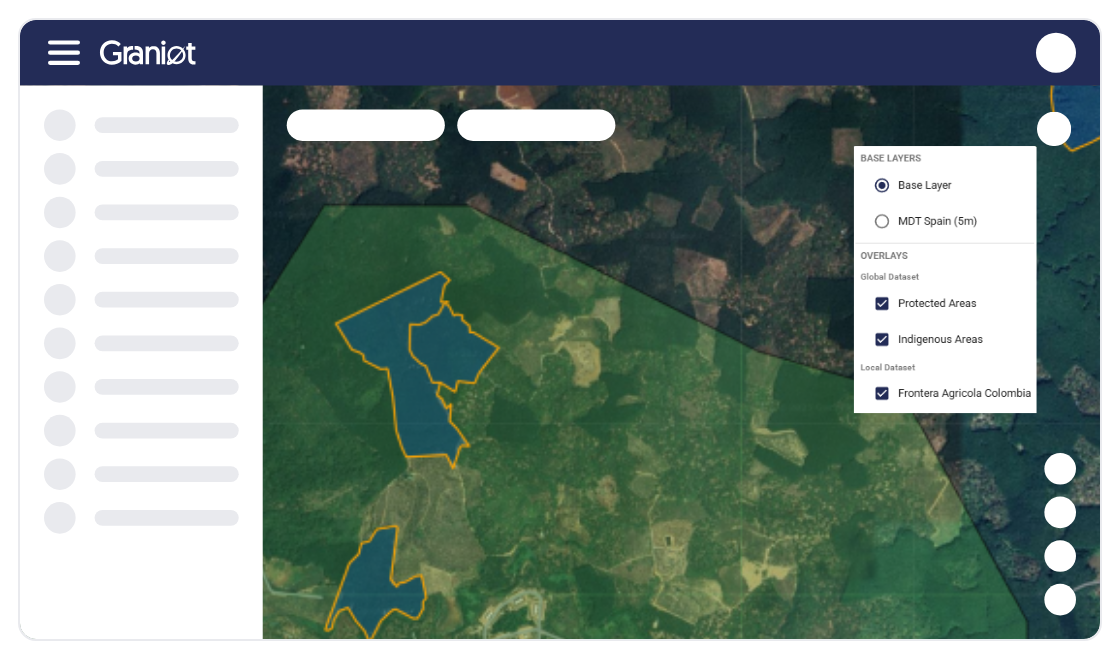
Access country-specific information layers updated regularly. Verify that your assets don't impact protected areas or indigenous territories, ensuring full legal compliance across your supply chain.
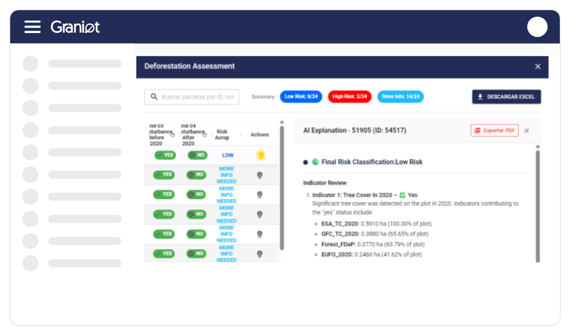
Download detailed reports in PDF or Excel with deforestation analysis results. Get the evidence needed to pass audits and export your products with full confidence.
Flexibility is key. Discover how our technology adapts to your needs — through our platform, API integration, or embedded maps.
Designed for B2B systems. Submit batches of polygons and receive automated classification and reports.
We process thousands of geometries without bottlenecks. Eliminate critical logistical delays in export.
Show results (risk classification, protected areas) directly on your own platform — no additional development required.
Avoid costly fines and market restrictions.
Solution designed for easy integration (via API or embedded map) into your traceability platforms.
We are your geospatial engine. Thanks to our architecture, we have processed more than 30,000 geometries and 1,600,000 hectares across Latin America, Europe, Africa, and Southeast Asia. Fast, reliable, and built for the speed of your business.


I see the real condition of every tree and apply inputs only where my crop actually needs them.

I process thousands of parcels in a single submission and get the results without operational bottlenecks.

Now I have the exact inventory of my trees and real control over what's happening on my estate.
I have all my parcels organized on the platform and it saves me a lot of time every day.

Graniot's embedded maps let us easily incorporate satellite technology into Dataris.
Send us your questions or requirements. Our team of experts will contact you to design a tailored solution that boosts your operational efficiency.
Get a continuous view of your plantation's health through advanced vegetation indices, anticipating water or nutrient problems and making decisions based on real, up-to-date data.

Use geospatial intelligence for tree-by-tree analysis, enabling precise inventory management, growth-anomaly detection, and optimized input use across every sector of your estate.

Monitor construction progress and pavement condition remotely, using satellite data to prioritize preventive maintenance and drastically reduce technical inspection costs.
How is Graniot different from other EUDR solutions?
We are API-first and embeddable. This means faster integration and the ability to process large data volumes (proven scalability), without the client needing to build their own GIS infrastructure.
What final product do I receive to upload to TRACES-EU?
You'll receive a validated GeoJSON file compatible with the TRACES system. You also get the report with detailed per-parcel analysis information.
What do the risk levels (Low, More Info, High) mean?
Low Risk: The parcel is deforestation-free. More Info Needed: Ambiguous signals (clouds, shadows) requiring additional review. High Risk: Deforestation detected.
Who is this service designed for?
It's designed for exporters, cooperatives, aggregators, and especially traceability companies and ERPs that need to integrate a reliable deforestation-verification layer.